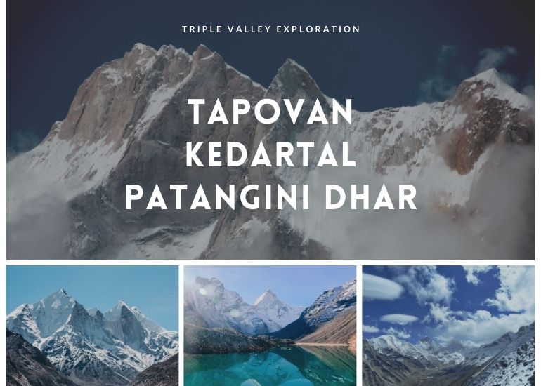
Tapovan – Kedar Tal – Patangini Dhar
13 Nights 14 Days Tour
Highlights
- Walk to the origin of 03 Massive Glaciers (Gaumukh, Kedar Bamak and Meru)
- Walk in the shadows of over 15 Himalayan peaks in 6000mts – 7000mts range
- High altitude exploration into 3 valleys of Gangotri National Park
- Highest altitude to reach – 5000mts
- Challenging Trek of over 110kms to be covered in 14 days.
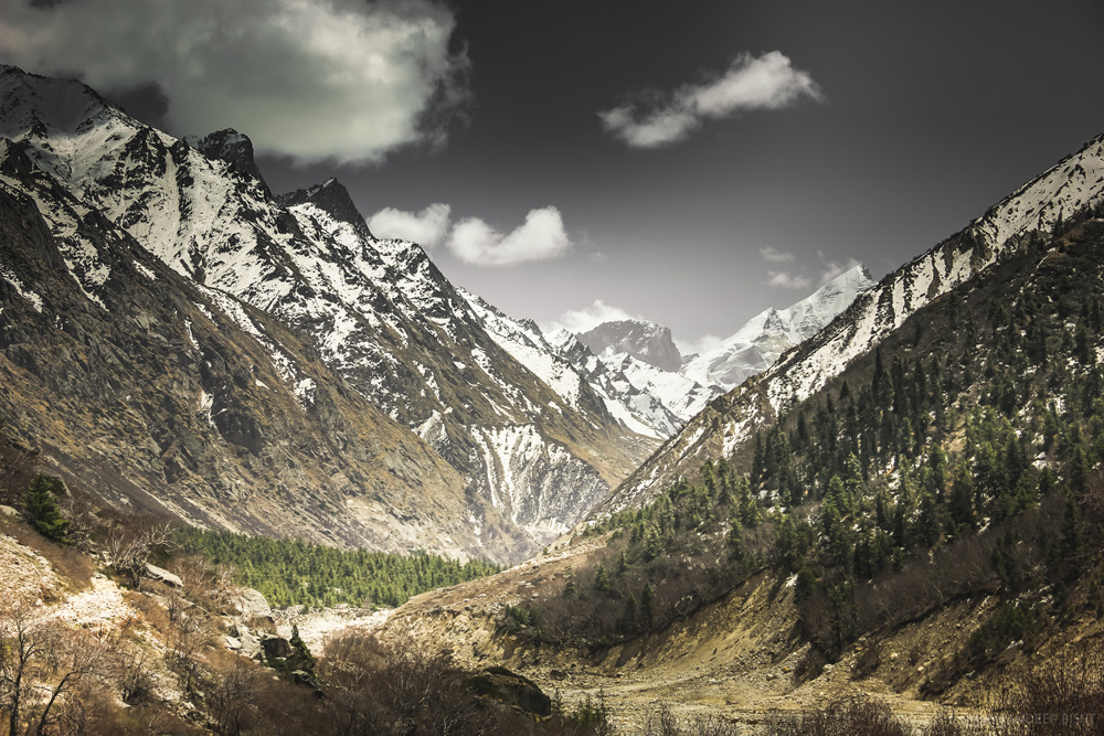
The highlands of Gangotri National Park
This has to be one of the most satisfying treks in the Garhwal Himalayas where you not only camp at the foot of lofty Himalayan peak but also enter 3 different valleys to its core. The trek starts with entering the Gaumukh Glacier, the origin of Ganga River and onwards to Tapovan, we then return to Gangotri and continue the trek to Kedar Tal after which we climb the breathtaking ridge of Patangini Dhar and return to Gangotri via Rudragaira Valley. The best way to put this trek in three words would be – the holy trail.
One of the sacred Char Dham, Gangotri Temple is a key attraction of this trek. Gangotri is the place from where Bhagirathi River descends. It is situated at an altitude of 3,048mts above sea level and acts as the base camp of the trek to Gaumukh Glacier.
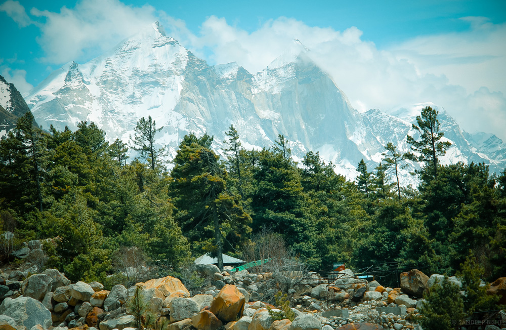
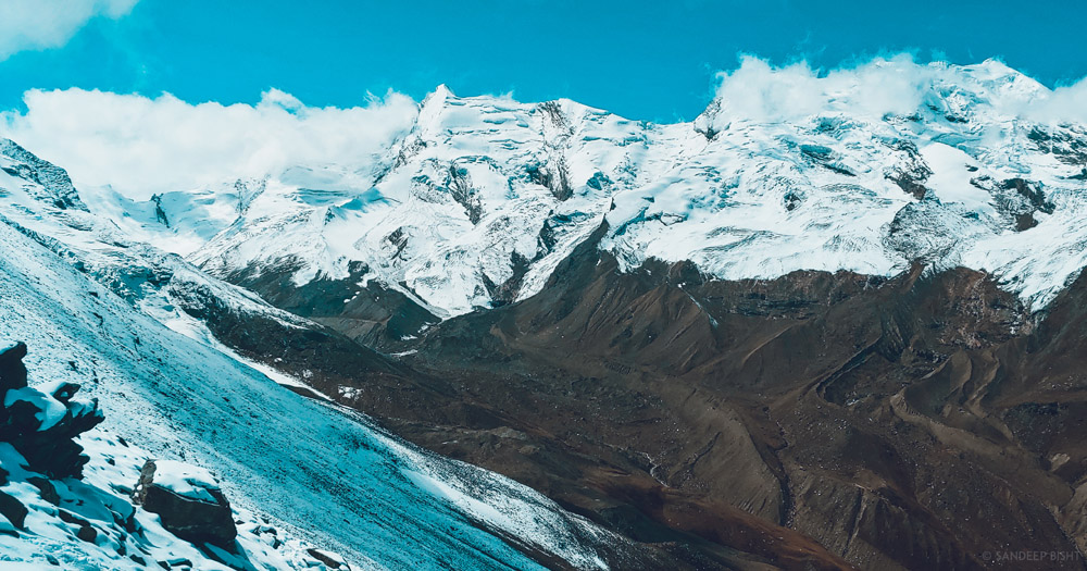
Gaumukh is the second largest glacier of India, first one being Siachen. Gaumukh Glacier is 30kms in length and approximately 4kms wide. The Himalayan peaks visible during this trek are Shivling, Meru, Bhagirathi sisters, Kharchkund & MORE.
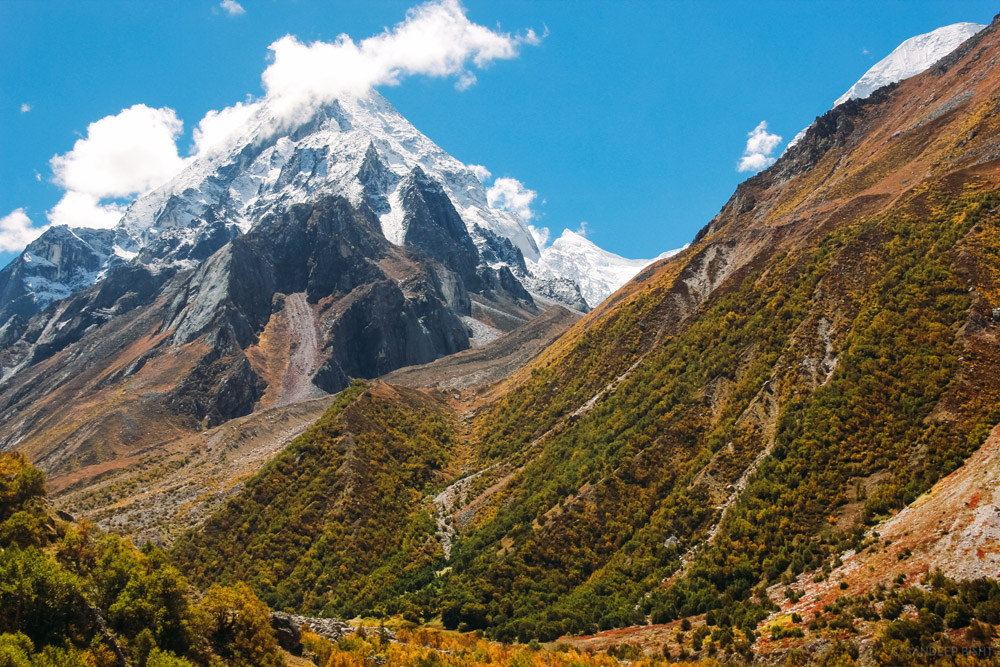
Kedar Tal is an emerald lake resting next to Kedar Bamak Glacier at the foot of lofty Thalaysagar (6,904) and Brigupanth Peak (6,772mts). Kedar Bamak Glacier is the source of Kedar Ganga which acts as an important tributary of Bhagirathi River. At 4780mts above sea level, Kedartal is a picture perfect high altitude lake.
This trekking route is open from May to October but avoid visiting this region during monsoon. Gangotri National Park remains closed during winters as it is prone to heavy snowfall.
All Pictures are owned and copyrighted by Sandeep Bisht for Meraki Triangle
Detailed Itinerary
Itinerary
Day 01: Dehradun – Gangotri
Drive – 255kms, 9-10hrs
Uttarkashi is one of the major towns of Uttarakhand thus buses and shared cabs are easily available from Dehradun & Rishikesh. The massive Tehri Dam Lake also comes into view as you proceed towards Chilyanisaur. After a short break at Uttarkashi continue another 3 hours drive to reach Gangotri.

Gangotri Dham
Day 02: Gangotri – Chirbasa
Trek – 9kms
Visit the sacred shrine of Goddess Ganga and buy all the necessary items from the market. The trek starts with a decent trail and it remains the same till further 2kms where you need to show permits. As you walk deep into the valley the vegetation also decreases. Continue trekking to reach Chirbasa which is situated 9kms from Gangotri Town. Cross small streams en route to Chirbasa. Chirbasa is a good campsite and the last point where you’ll see good vegetation. You can camp here if there are any signs of AMS. Chirbasa is situated at an elevation of 3,580mts above sea level.
Distant view of Chirbasa
Chirbasa Campsite
Day 03: Chirbasa – Bhojwasa – Gaumukh Glacier View Point & Return
Trek – 12kms
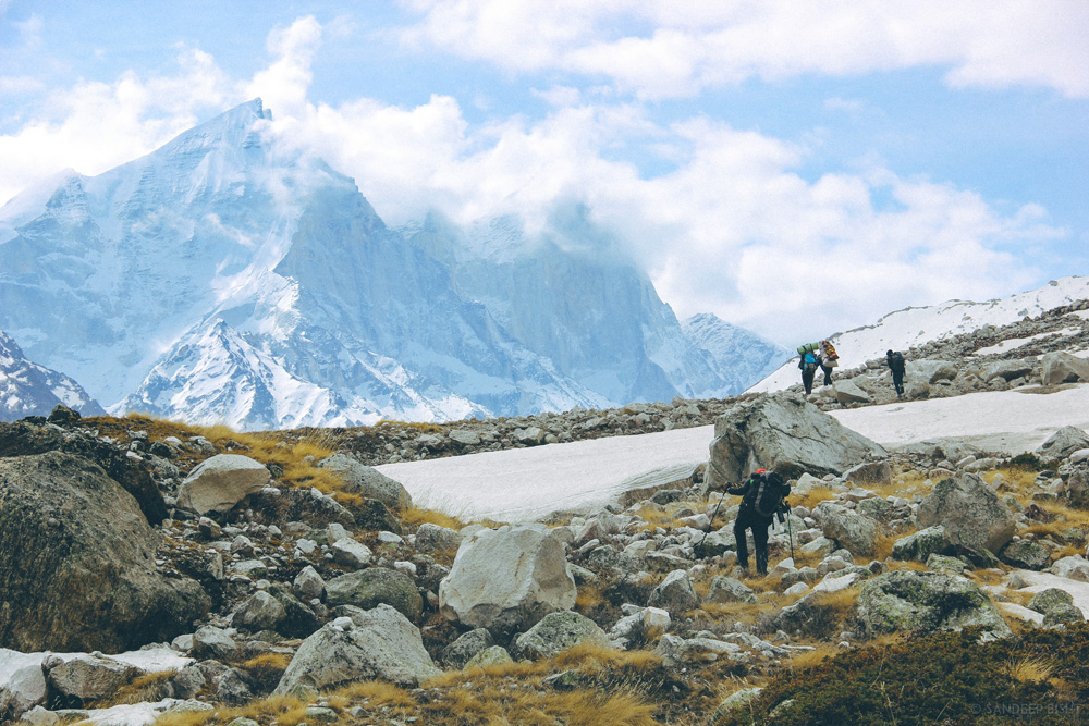
Bhojwasa is located 5kms from Chirbasa. Bhagirathi Peaks stands high above the ground and is constantly visible during the trek. The trail not only goes through rugged terrains along with the Bhagirathi River but also climbs up to rugged mountains. Bhojbasa is a vast open expanse of land in the valley, situated at an elevation of 3,800mts above sea level.
There are two routes by which you can reach Tapovan. First one being the classic route via Gaumukh Glacier for which you need to follow the trail going to Gaumukh which can be seen on the left side from Bhojwasa. Gaumukh Glacier is 4kms from Bhojwasa. But due to recent collapse of the snout of the glacier it is in a delicate state. Visit Gaumukh Glacier and return to Bhojwasa in order to get acclimatized.
For later half of the day you can visit ashrams at Bhojwasa to perform aarti or stroll around the Bhagirathi River, gazing at Bhagirathi Peaks in total awe.
Gangotri National Park
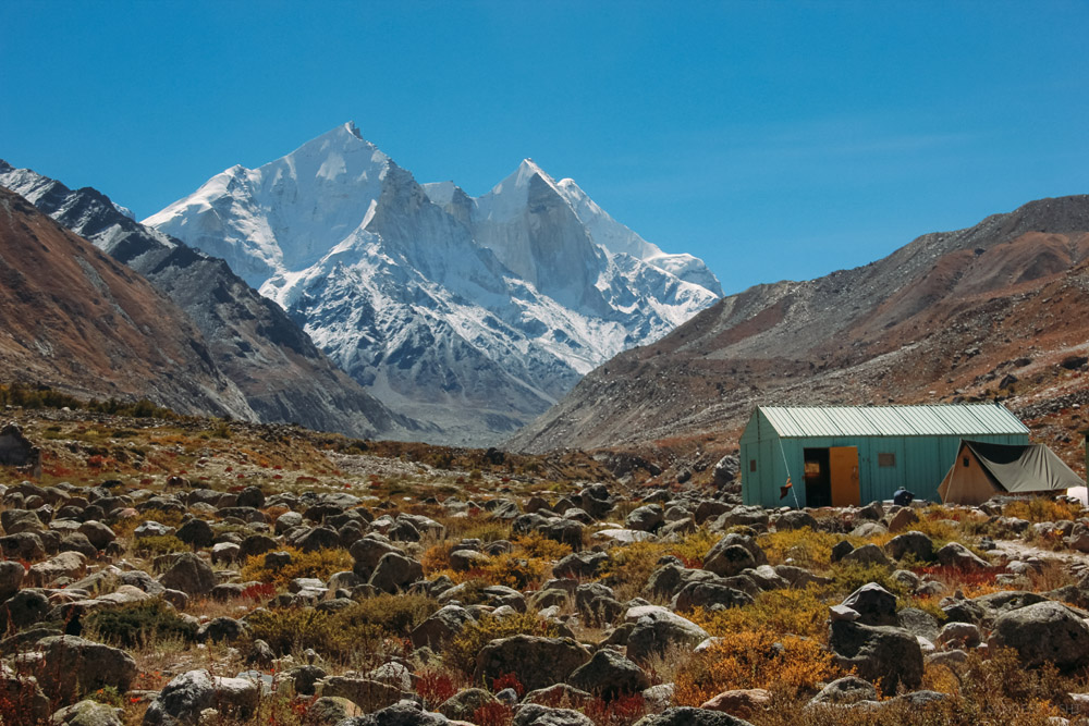
Bhojwasa Campsite
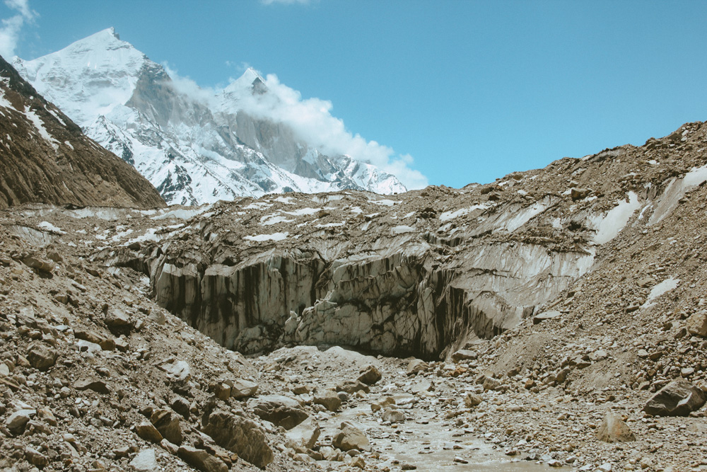
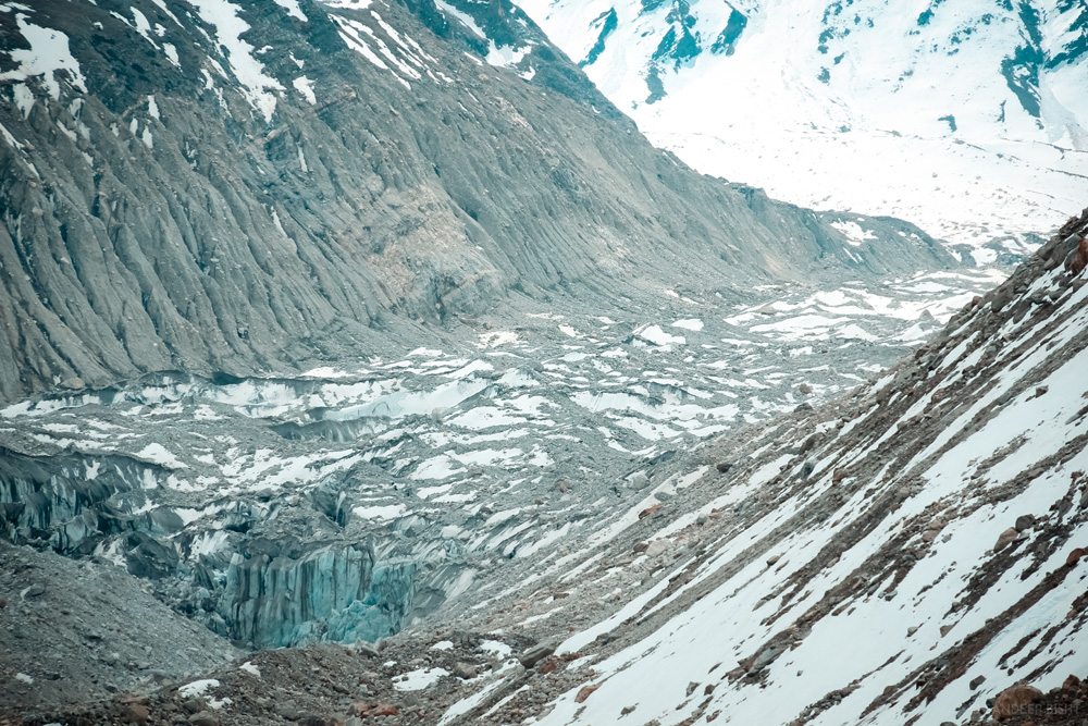
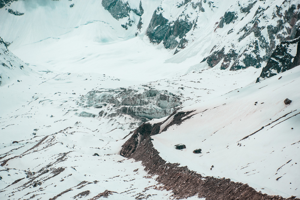
Gaumukh Glacier
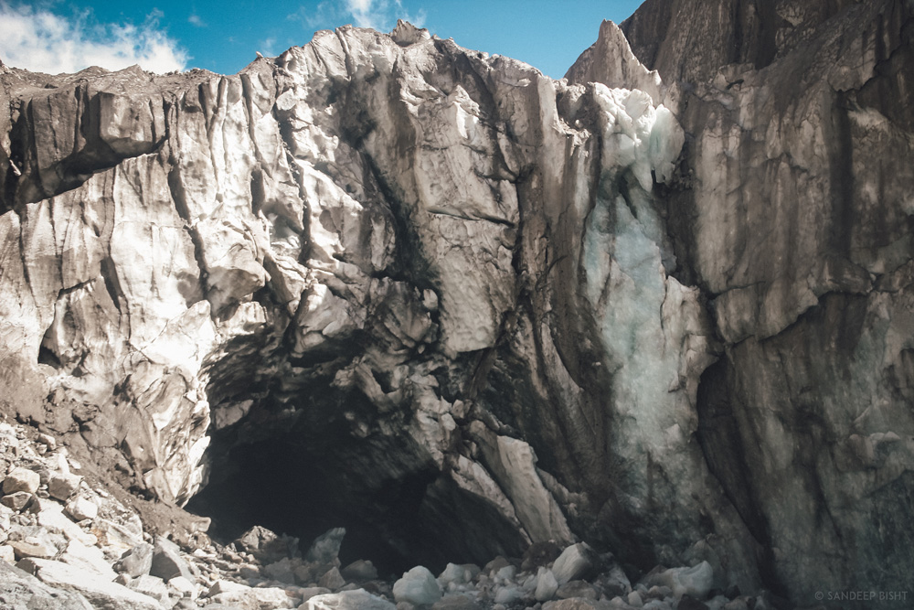
The Snout of Gaumukh Glacier
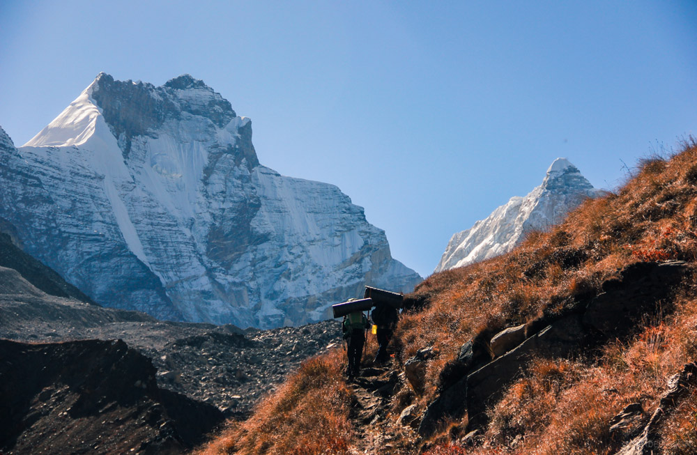
Day 04: Bhojbasa – Tapovan
Trek – 10kms
The second route requires crossing Bhagirathi River from Bhojwasa itself. You need to walk on moraines for many kilometers with constant view of Gaumukh Glacier from distant. Climb the ridge covered with snow to reach Tapovan. Tapovan campsite is located at the foot of Mount Shivling (6,543mts), just a glance of this mountain is a priceless gift of this trek. And if Shivling peak is not enough then Kharchkund & Meru Peak will definitely leave you speechless. Tapovan is situated at 4400mts above sea level.
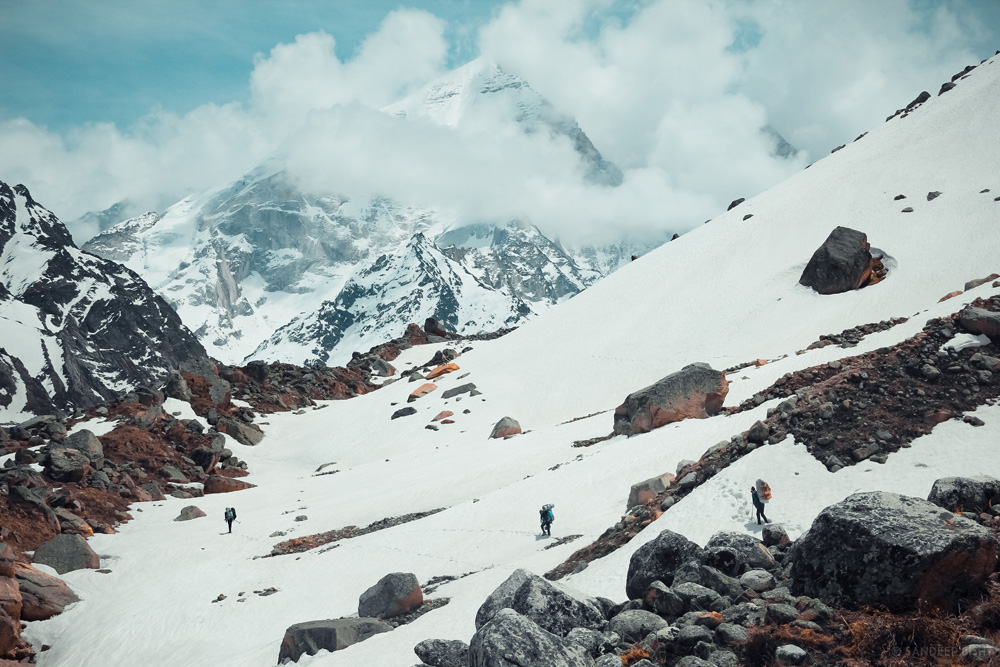
Bhagirathi II and the snow covered trail to Tapovan
Gaumukh Glacier Aerial view
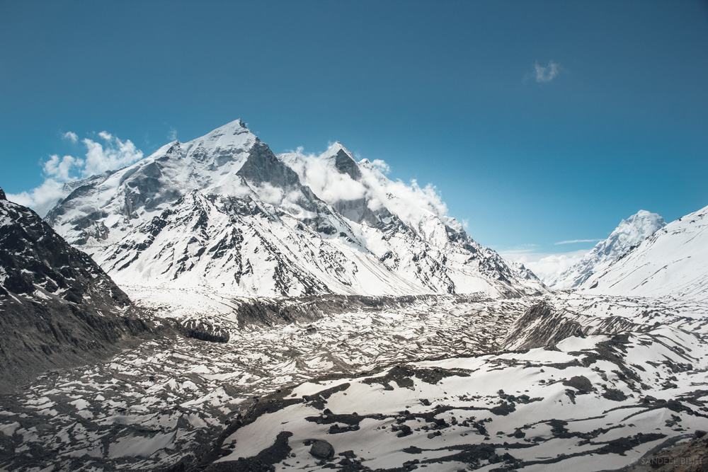
The wide expanse of Gangotri Glacier
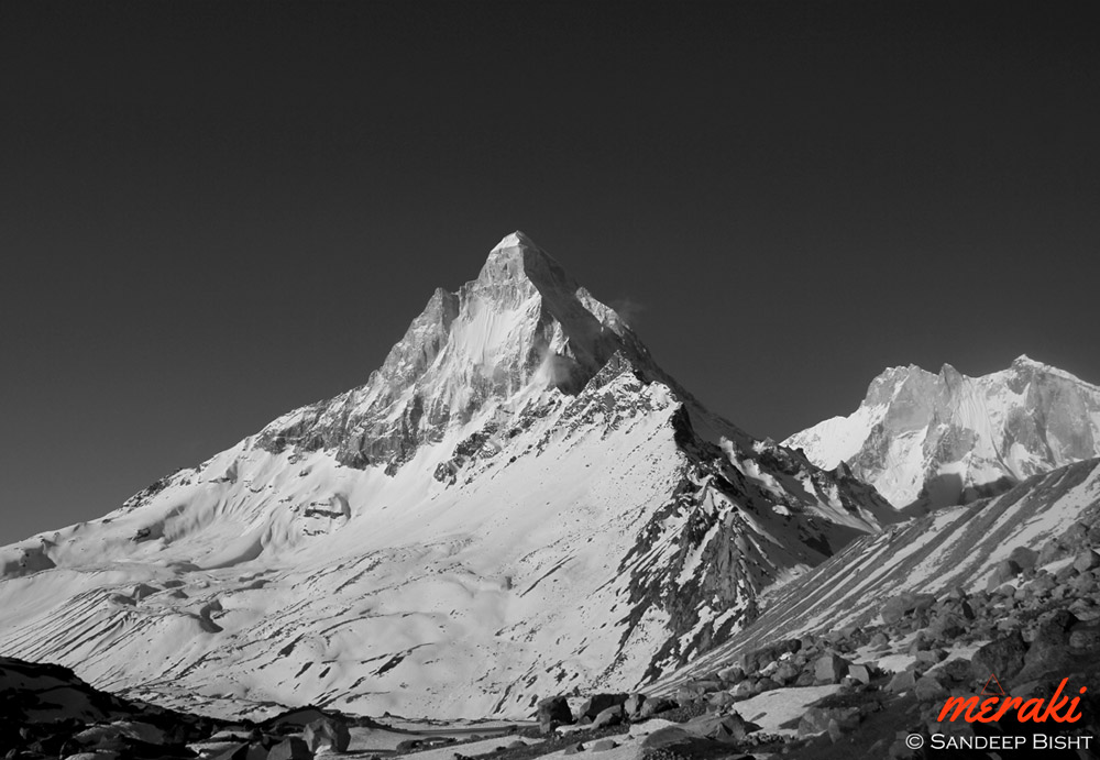
Shivling Peak – 6543mts above sea level
Day 05: Tapovan – Meru Glacier – Tapovan
Trek – 9kms
There are couple of options to roam around for the day at Tapovan, you can either explore the highlands of Tapovan where Akash Ganga ceaselessly passes through the wide meadow overlooking Shivling Peak on right and Bhagirathi Peaks on left. Our personal recommendation for this day is an up close view of Meru Peak. It takes around 3 hours of walk over moraines to reach the snout of Meru Glacier.
Meru Peak
Meru Glacier
Day 06: Tapovan – Bhojwasa
Trek – 10kms
The trek starts off with rugged terrains and moraines. Descent on moraines will require extra attention from your legs while trekking. Trek slowly and take a break after you reach the snout of Gaumukh Glacier to experience its massiveness. This is the point where the holy Ganges emerges from, it all begins here. Further trek down to reach Bhojbasa.
Alternate Trail to Tapovan

Weather House at Bhojwasa
Day 07: Bhojwasa – Gangotri
Trek – 14kms
Trek down via same route from Bhojbasa to Gangotri, at a leisure pace though. Save your leg for next climb to Kedar Tal.
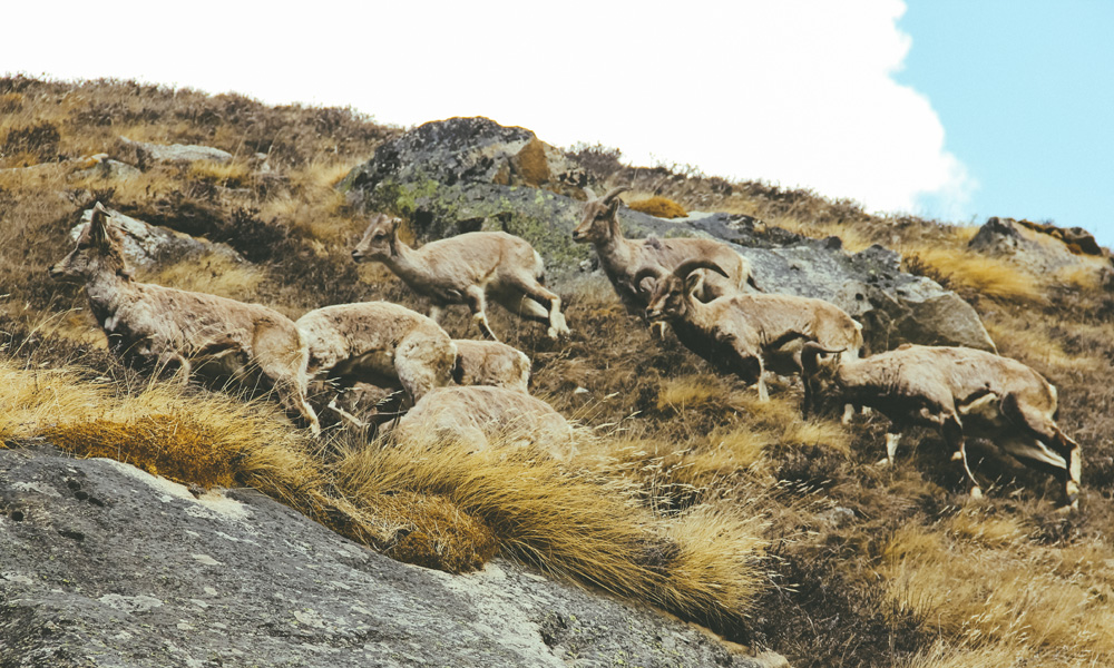
Blue Sheep – Bharal
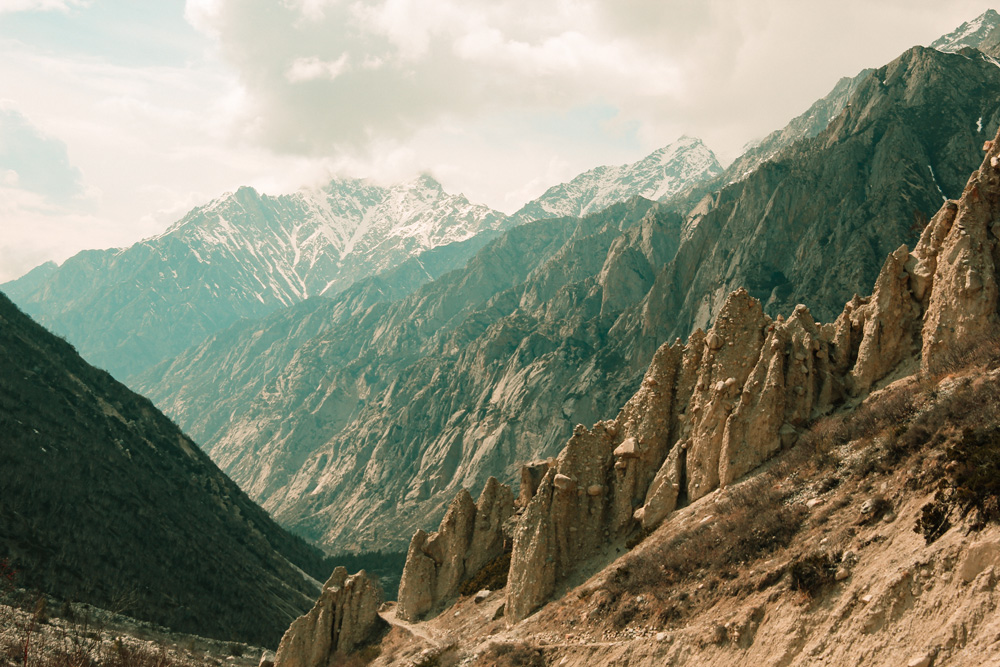
Unusual mud and rock formation on the way to Bhojwasa
+ 01 Rest Day / Buffer Day
Day 08: Gangotri – Bhoj Kharak
Trek – 8kms
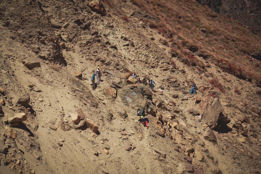
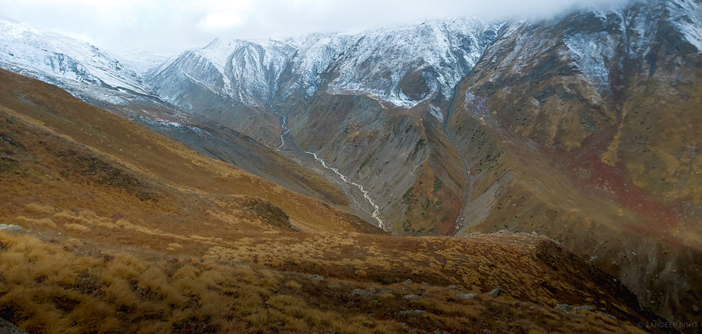
Cross the bridge over Bhagirathi River and start the climb on the right side. First few kilometres of the trek are very steep so try to walk with a slow yet constant speed. The trail initially passes through pine trees then enters a mix vegetation zone of fir and bhoj trees. During this trekking stretch you’ll see Kedar Ganga flowing on your left, deep down in the gorge. The sound of the furious river and the whispering sound of trees are a treat to ears.
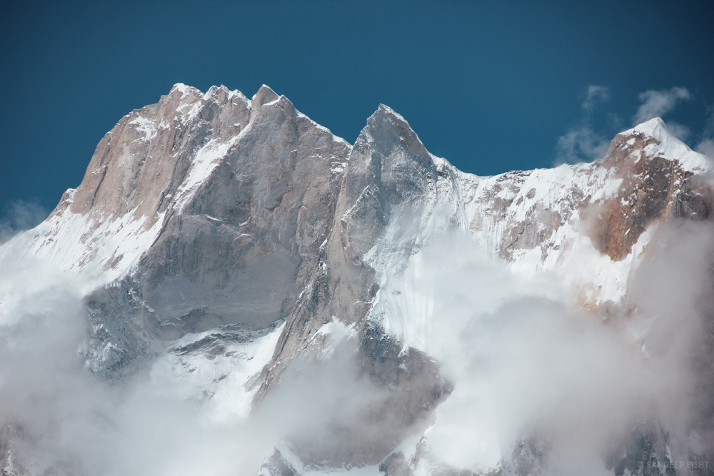
Soon you’ll witness the first view of Thalaysagar and every step will take you closer to this stunning mountain. Just before reaching Bhoj Kharak there is a slant rock amidst the trail with space of just a few steps, it has been named Spider Wall by few bloggers. But while it may seem daunting in the pictures, it is not that difficult to traverse this section in the absence of snow. During early June or late October if the rocky face is covered with snow then it will require some skills to cross this section because one slip can drag you to few hundred feets below. Crossing this section will lead you to Bhoj Kharak.
Situated at the elevation of 3,780mts above sea level Bhoj Kharak is a small and an average looking campsite. If you are fit and managed to reach Bhoj Kharak at around noon, then keep it an option to reach Lower Kedar Kharak on the same day.

Aerial view of Gangotri

Bhoj Kharak and Thalaysagar
Day 09: BhojKharak – KedarKharak
Trek – 5kms
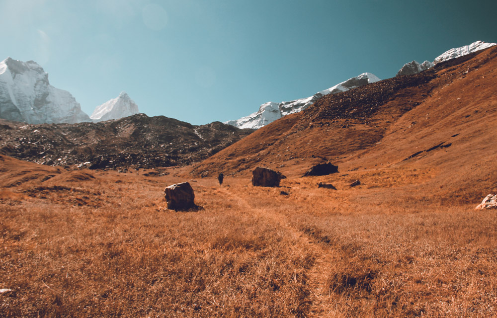
This 5kms stretch passes through some patches of complicated rugged terrains. After every half an hour into the trek you’ll see a pleasant change in the scenery. Initially it starts with a flora rich trail with numerous Bhojpatra trees and colourful wild bushes around. Soon the view changes with Manda peaks revealing itself.
Stunning views of Bhrigupanth peak will also catch up as you trek nearer to Kedar Kharak.Concentrateoneverystep while you cross the landsliding zone of Gila Pahar. IfthissectionofGila Pahar is in very bad shape then try and trek down all the way to Kedar Ganga, cross the river and hike against the river flow until you cross the Gila Pahar intersection then cross the river again and hike back to the original trail that leads to Kedar Kharak.
A wide valley opens up as you proceed towards Lower Kedar Kharak (4100mts) and the trekends up at the beautiful meadow of Kedar Kharak situated at an elevation of 4,280mts above sea level. Even though this trekking stretch is just 5kms long, it demands good physical strength and endurance from trekkers. But in the end it is a well paid off effort because Kedar Kharak is one of the most beautiful campsites in the Gangotri National Park region. Also, Bharal (Blue Sheep) often visit here for grazing, making it a picture perfect location for photographers. The sight of Bhrigupanth and Thalaysagar peaks standing high together is like a surreal dream.
Trekking towards Kedar Kharak
Landslide zone
Kedar Kharak
Day 10:KedarKharak – KedarTal– Kedar Kharak
Trek– 10kms
It takes another 5kms to reach Kedar Tal from Kedar Kharak and most of the route is on moraines and glacier covered with moraines. If trekking in June you might have to trek on snow for last couple of kilometres before Kedartal. Cross the brook carrying icy cold water and climb the steep rocky terrain. Keep following the cairn markings to ensure that you are on the right trail.
After climbing the final ridge, Kedar Bamak Glacier comes in the view along with its glacial lakes. The foot of Mt. Bhrigupanth and Mt. Thalaysagar merges with the Kedar Bamak Glacier. An hour further into the trek reveals a beautiful high altitude lake, the immaculate Kedar Tal. The view of Thalaysagar peak reflecting on the still water of Kedartal is mesmerizing.
Kedar Tal is situated at an altitude of 4780mts above sea level. AMS is quite common at such altitude so it is better to go for an acclimatization hike. We do the parikrama of the lake as it will not only get you well acclimatized but will also showcase the best views of Thalaysagar peak. Trek back to Kedar Kharak.

Kedar Bamak Glacier

Thalaysagar and its West Ridge

First look of Kedar Tal

Kedar Tal – 4780mts
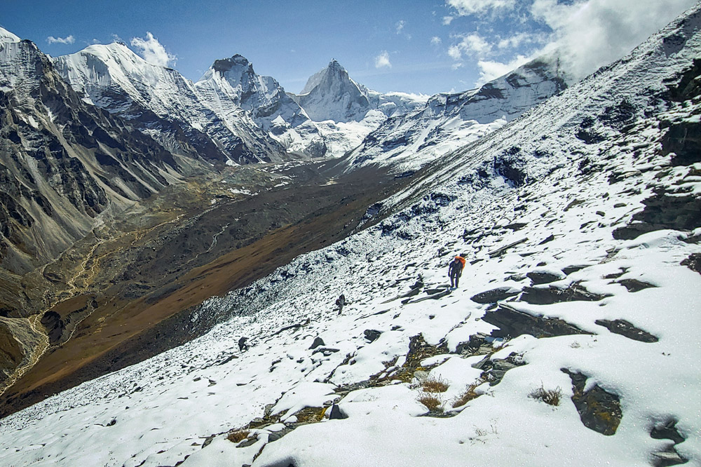
Day 11:Kedar Kharak– Patangini Dhar Base Camp
Trek – 5kms
We hike up on the meadows above Kedar Kharak to reach the higher grounds of the right side of where the Kedar Kharak starts from and proceed further to reach an almost hanging campsite. Since Patangini Dhar is situated at around 5000mts, it is better to camp here and approach the pass next morning.
While this climb is short, it is very steep and may require some good effort for you to reach there. The base camp will be much colder than Kedar Kharak and exposed to winds, but the views of Manda Peaks, Bhrigupanth and Thalaysagar makes up for it.

Kedar Kharak Campsite (4270mts)

Distant view of Patangini Dhar

Bharal – Blue Sheep

Patangini Dhar Base Camp
Day 12: Patangini Dhar Base Camp – Patangini Dhar – Rudragaira Valley Camp
Trek – 6kms
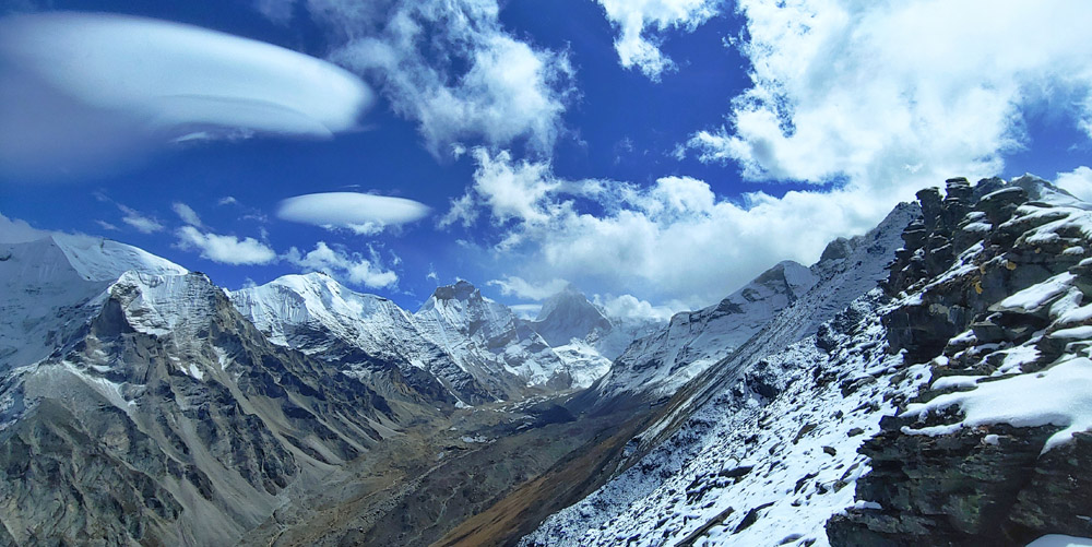
The most challenging climb during this Chhota Vanvaas comes right before you are about to enter the 3rdvalley in Gangotri National Park. From the base camp to Patangini Dhar it is around 1.5 to 2kms steep gradient slope of 65 degrees, partly on rock slabs. It may take around 3 hours to reach the top. Once you reach Patangini Dhar (4915mts) the much awaited Rudragaira Valley opens up to showcase Gangotri Peaks, Jogin and Auden’s Col. You also get to see the eye level view of Chirbas, Manda, Bhrigupanth and Thalaysagar from here.
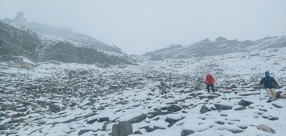
The descent on the other side from Patangini Dhar to Rudragaira Valley is also notorious with exposed cliffs and downhill route via boulders and uneven rocks. When partially covered with snow they become even more challenging to traverse. At the end of the moraine section there is a small meadow path with a stream flowing 100mtrs below, one can camp here or proceed towards a lower campsite. For which we would need to traverse a long section of hanging meadows. We decide depending upon the remaining daylight or weather.

Leaving from Patangini Dhar Base Camp
The steep climb to Patangini Dhar
Patangini Dhar
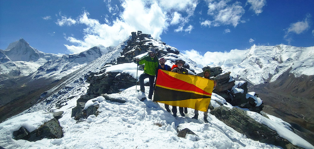
The Team at Patangini Dhar
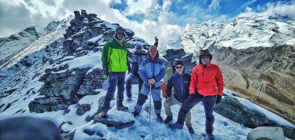
The Team at Patangini Dhar – 5000mts
Patangini Dhar Descent
Day 13: Rudragaira Valley Camp – Gangotri
Trek – 13kms
We start from Upper Nala Camp in an attempt to reach the Rudragaira River and cross it near Nala Camp. It is a long way and sharp way down through grassland, bushes and rhododenrons which keep appearing as altitude decreases. Then a gully on the left reaches out to a point from where river crossing can be managed with getting waist deep in the freezing glacial waters. From Nala Camp the route is well made all the way to Gangotri and passes through trees, waterfalls a few landslide sections and birch trees with Rudragaira river accompanying us constantly. The route is mostly flat with a short ups and downs on the trail, the route inclines when we cross the river and keep on the right side to reach Gangotri. Pray at the temple again after completing your Chhota Vanvaas in the highlands of Gangotri National Park. The three valleys exploration in 2 weeks is a stunning feat to accomplish.
Audens Col and Gangotri Group of Peaks
Getting down to Nala Camp in Rudragaira Valley

Rudragaira Valley
Day 14: Gangotri – Dehradun
Drive: 255kms
Drive back to Dehradun via Uttarkashi. Buy a souvenir from Gangnani and take a dip in the natural thermal spring before continuing the journey back.
Inclusions
- Accommodation in Gangotri in Hotel (3Nights)
- Premium Dome tents during trek on twin sharing
- All Veg Meals during Trek (Trail Snacks, Packed Lunch / Hot Lunch, Daily Breakfast & Dinner)
- All Trekking equipment (Tents, Sleeping Bags, Mattress, Kitchen Tent, Toilet Tent, etc)
- Porter, Cook & Guide Charges
- Forest Camping Charges, Entry Fees & Permits
- Services of Experienced Trek Leader
Exclusions
- Any sort of transportation
- Bag Offloading
- Any personal expense
- Travel Insurance
- Anything not mentioned in inclusions
- GST
Post Comments/Questions on “Tapovan – Kedar Tal – Patangini Dhar”