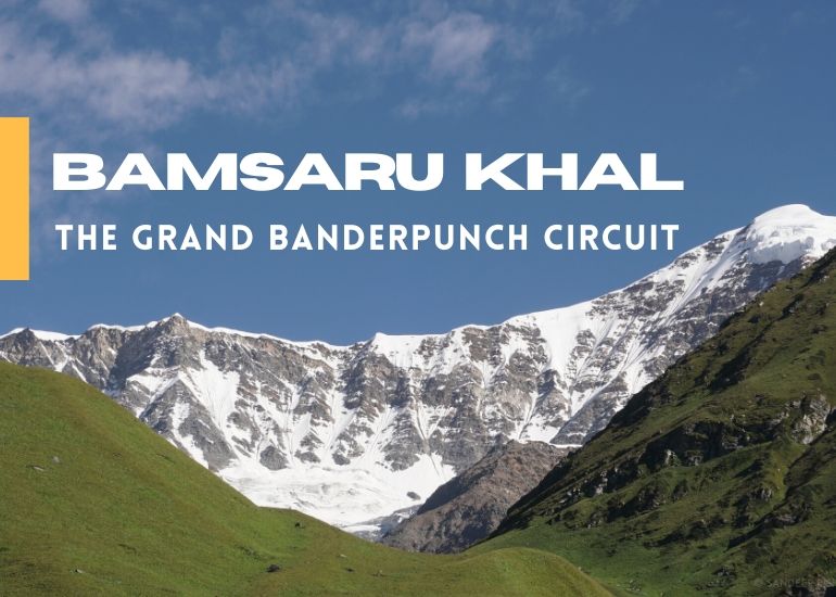
Bamsarukhal
8 Nights 9 Days Tour
Highlights
- Complete Twin high altitude pass exploration and walk on sharp ridges
- Walk the high altitude alpine meadows of Gidara Bugyal
- Get up close with Banderpunch Massif, Black Peak and Gangotri Ranges
- Visit the birthplace of Lord Ganesha – Dodi Tal
- Less frequented trek with scenic campsites
A twin pass exploration of Darwa Pass and Bamsarukhal includes the highlights such as Dodi Tal and Gidara Bugyal. This is a classic Himalayan exploration that offers an entirely different perspective of Banderpunch Massif while you walk through dense forests, alpine meadows stunning ridges. The best time to do this trek is June, September and October.
Detailed Itinerary
Day 01: Dehradun – Uttarkashi – Kuflon
Start in the morning from Dehradun or Rishikesh to Uttarkashi. The massive Tehri Dam Lake also comes into view as you proceed towards Chilianisaur.
Buy all necessary items from Uttarkashi if you left out on anything. Kuflon is just 10kms from Uttarkashi at an elevation of 1,300mts above sea level. The trek to Mugdha Tal commences from Kuflon, estimated time to reach is 2pm. After reaching Kuflon it’s a brisk hike of 5 to 10 minutes and you will reach our base camp.
Day 02: Kuflon – Sangam Chatti – Agoda
Trek – 12kms
Ideally the trek to Dodi Tal starts from Sangam Chatti but we will hike from Kuflon to Sangam Chatti for 4kms which is mainly on road. It takes an hour to cover this 4kms stretch, moreover it acts as a warm up session before the trek begins. The trekking trail begins as soon as you cross the bridge over a small stream. The trail passes through the last village enroute, Agoda. Trekkers who are in a hurry reach Agoda Village on Day 1 itself after doing an evening hike. It takes around 2-3hrs to reach Agoda from Sangam Chatti.
*A new road undergoing construction will allow us to reach Agoda Village on Day 01.

Agoda Village

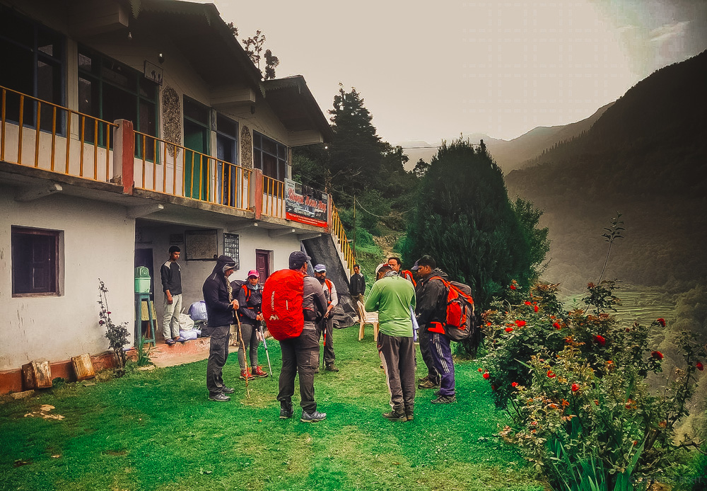
Morning briefing session before trek
Day 03: Agoda – Dodital
Trek – 16kms
Just 2kms into the hike leads us to the beautiful campsite by a stream at Bebra. There are a few huts and shop at Bebra to freshen up. The first four kilometers from Bebra to Dharkot is a steep climb and takes minimum two hours. The gradient of the trail goes through few ups and downs after Dharkot. Dense forest of oak, deodar & rhododendron trees can be seen on the trail along with deep gorges and aerial view of Asi Ganga river. Manjhi is a small seasonal settlement with few shepherd huts, situated 5kms before Dodi Tal. It takes around 2 hours to reach Dodi Tal from Manjhi.
Dodi Tal is a hidden lake nestled amidst dense forest at an altitude of 3,010mts above sea level, The region is ideal for birdwatchers and trekkers alike. There is a Forest Rest House in Dodital along with couple of shacks & basic cottages that provide accommodation. The lake is named after the rare Himalayan Trout which is known as Dodi in regional dialect. A very less heard of temple is located in the premises of Dodi Tal which is considered to be the birthplace of Lord Ganesha.

Dodi Tal

Dodi Tal
Day 04: Dodi Tal – Darwa Pass
Trek – 6kms
The climb from Dodi Tal to Darwa Top is quite steep. The initial 2kms of the trail is mainly moraine and stream bed, after you reach a flag point, verge into the left valley. The steep route to Darwa Pass starts here. Darwa Top is more or less 1km further from Darwa Pass. Banderpoonch Massive, Kala Nag, Kedarkantha, Swargarohini & Gangotri ranges are significant peaks visible from the top. Darwa Top is situated at 4150mts above sea level can be kept for acclimatisation ascent in the evening to gaze the golden hour amidst Himalayas.
Climb towards the alpine meadows and sharp ridges while unobstructed views of Banderpunch Peak accompanies you. The amphitheatre of peaks makes it a top of the world campsite hence we kept this laidback day in the itinerary. Spend a calm evening in the high altitude with amazing views while adjusting with the atitude.

Aerial View of Dodi Tal

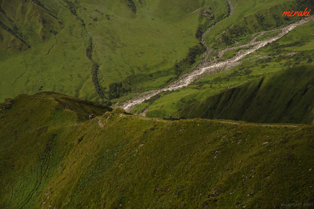
Ridges beyond Darwa Pass
Day 05: Darwa Pass – Bingad
Trek – 14kms
Start early in the morning and explore the gorgeous ridge walk extending towards the Bingad Valley. You get to see the aerial view of Dodi Tal while covering this trail. The alpine meadows are carpeted with flowers following sharp ridges on the right. We cover the meadow stretch and start descending down to Bingad through steep descent over meadows and rhodendron bushes.
Once above the Hanuman Ganga, we need to traverse through a few streams and rocky section. Bingad makes a gorgeous campsite with Banderpunch Ridge in the front and the Bamsarukhal valley rising on the right beholding secret views to be saved for next day.


Bingad Campsite

View from Bingad
Day 06: Bingad – Bamsarutal
Trek – 4-5kms
There are dense bushes of rhododendrons and other vegetation here specially during post monsoon period and that compliments with the view. From Bingad we hike upwards while staying on the right climbing right after crossing the river.
Brahmakamal can be found in plenty on this trail, some even in the bunch of 4-6 knitted together. From Bamsaru Tal you will see a clear view of Banderpunch I & II and its reflection on the lake is a photographers delight. Around the elevated ridges of Bamsaru Tal there are few good camping grounds available, choose one which is nearest to a water source.
For better acclimatization and a stunning sunset view you can climb up to the ridges beyond Bamsaru Tal. While hiking above you will witness diminishing of meadows with boulders and moraines taking over. The Bamsarukhal route will be on the left incline through a gully, follow the moraines on the right edge of the horizon. From here you will see the back side of Gidara Bugyal spreading far out towards the ridges of Uchlad, Surya Top and way back Dayara Bugyal will also look familiar. Below will be the cliff-hanger meadows and ridges following by the forest line reaching out to Chola Dhuni. Get back to the campsite before it gets dark.

Bamsaru Tal

Bamsaru Tal after fresh snowfall

Banderpunch Massif
Day 07: Bamsaru Tal – Bamsarukhal – Gidara Bugyal
Trek – 14kms
We start from Bamsarukhal early morning to reach the pass with clear weather. The walk on moraines will get tiring as we venture upwards. Soon the steep climb of BAmsarukhal will come into view when the cairns on the top becomes identifiable. It will maximum around 3hours to reach the top and it will immediately pay off with the views this pass was holding on to. The vast ridges of alpine meadows and sharp ridges are breathtaking and we still will be exposed to one third of what Gidara Bugyal has to offer.

The final climb to Bamsarukhal
The descent is sharp but still a walkable path considering we have traversed the moraines. Fenkamal are found in abundance on the ridges following the path downwards to Gidara Bugyal. Fenkamal are generally rare and are of high medicinal values. They are often found above 4000mts and this is the place where you will find them the most in comparison with any other trek in Uttarakhand, specially during September.
As we navigate the downhill hike crossing multiple beautiful ridges, Gidara Bugyal gets wider and expands to multiple gorgeous valleys. We pick the best spot to get down for lunch, roam the meadow, take pictures and with a heavy heart continue downwards to camp at the end of Gidara Bugyal. This is the most widespread high altitude meadow of Uttarakhand ranging from 3500mts to 4000mts and one of the least explored trails.

Moraines of Bamsarukhal

Gangotri Ranges as seen from Bamsarukhal
Day 08: Gidara Bugyal – Bhangeli
Trek – 16kms
The reason we camped on the far end of Gidara Bugyal is because we will have a long way to reach Bhangeli Village and traversing Gidara Bugyal itself adds a few good kilometers to the itinerary. During this last day of Chhota Vanvaas we will be literally venturing out into the deep forests of Bhojpatra, Rhododendrons and Deodars while crossing the campsites of Thalotya, Dokrani and Rikoda.
We finally complete the trek by reaching Bhangeli village from where you’ll see the aerial view of Gangotri Highway, Bhagirathi River and Gangnani.

Gidara Bugyal
Day 09: Bhangeli – Gangnani – Dehradun
Trek: 1km | Drive: 190kms
Trek 1km down to the roadhead and drive to Gangnani. There is a natural thermal spring at Gangnani and a hot bath there to end the journey will be very much required to comfort our body muscles and for final cleansing during this Chhota Vanvaas. We drive comfortably back to Dehradun after that.
Inclusions
- Accommodation in Kuflon and Agoda Village at Meraki Triangle (2Nights)
- Premium Dome tents during trek on twin sharing
- All Veg Meals during Trek (Trail Snacks, Packed Lunch / Hot Lunch, Daily Breakfast & Dinner)
- All Trekking equipment (Tents, Sleeping Bags, Mattress, Kitchen Tent, Toilet Tent, etc)
- Porter, Cook & Guide Charges
- Forest Camping Charges, Entry Fees & Permits
- Services of Experienced Trek Leader
Exclusions
- Any sort of transportation
- Bag Offloading
- Any personal expense
- Travel Insurance
- Anything not mentioned in inclusions
- GST
Post Comments/Questions on “Bamsarukhal”