Kedar Tal & Patangini Dhar
7 Nights 8 Days Tour
Highlights
- The emerald Kedar Tal
- Walk to the foot of Thalaysagar and Bhrigupanth Peak
- Highest altitude pass crossing at 5000mts providing aerial view of Gangotri National Park
- Stunning views of Gangotri Ranges, Auden’s Col, Manda Peak and other massifs
- Difficult Trek giving good exposure of multi gradient trail to experienced trekkers
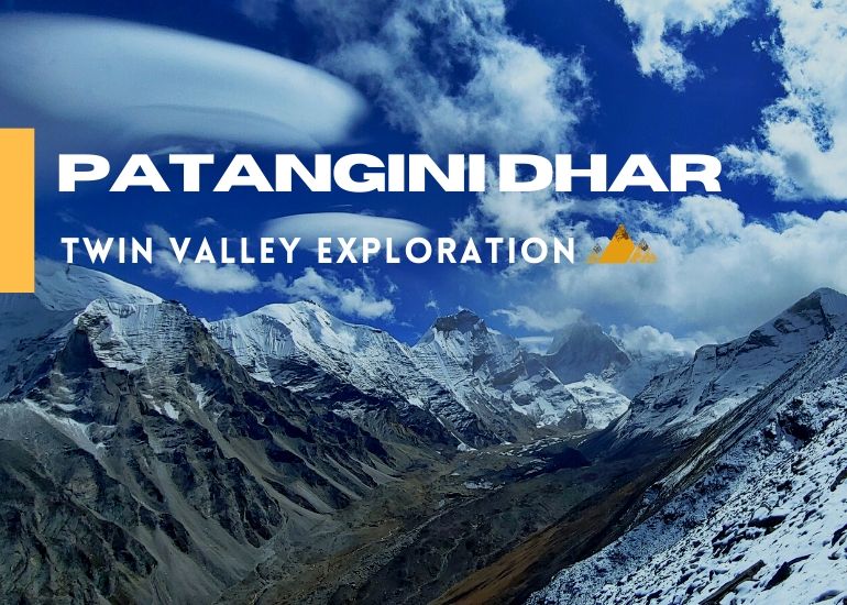
Twin Valley exploration in Gangotri National Park
This has to be one of the most satisfying treks in the Garhwal Himalayas where you not only camp at the foot of lofty Himalayan peak but also enter 2 different valleys to its core.
Kedar Tal is an emerald lake resting next to Kedar Bamak Glacier at the foot of lofty Thalaysagar (6,904) and Brigupanth Peak (6,772mts). Kedar Bamak Glacier is the source of Kedar Ganga which acts as an important tributary of Bhagirathi River. At 4780mts above sea level, Kedartal is a picture perfect high altitude lake. Whereas the climb of Patangini Dhar despite a demanding one, offers you with the best view in Gangotri National Park with the view of 2 amazing valleys guarded by giant Himalayan peaks.
This trekking route is open from May to October but avoid visiting this region during monsoon. Gangotri National Park remains closed during winters as it is prone to heavy snowfall.
Detailed Itinerary
Day 01: Arrival at Gangotri
Day 02: Gangotri – Bhoj Kharak
Trek – 8kms
Cross the bridge over Bhagirathi River and start the climb on the right side. First few kilometres of the trek are very steep so try to walk with a slow yet constant speed. The trail initially passes through pine trees then enters a mix vegetation zone of fir and bhoj trees. During this trekking stretch you’ll see Kedar Ganga flowing on your left, deep down in the gorge. The sound of the furious river and the whispering sound of trees are a treat to ears.
Soon you’ll witness the first view of Thalaysagar and every step will take you closer to this stunning mountain. Just before reaching Bhoj Kharak there is a slant rock amidst the trail with space of just a few steps, it has been named Spider Wall by few bloggers. But while it may seem daunting in the pictures, it is not that difficult to traverse this section in the absence of snow. During early June or late October if the rocky face is covered with snow then it will require some skills to cross this section because one slip can drag you to few hundred feets below. Crossing this section will lead you to Bhoj Kharak.
Situated at the elevation of 3,780mts above sea level Bhoj Kharak is a small and an average looking campsite. If you are fit and managed to reach Bhoj Kharak at around noon, then keep it an option to reach Lower Kedar Kharak on the same day.
Day 03: BhojKharak – KedarKharak
Trek – 5kms
This 5kms stretch passes through some patches of complicated rugged terrains. After every half an hour into the trek you’ll see a pleasant change in the scenery. Initially it starts with a flora rich trail with numerous Bhojpatra trees and colourful wild bushes around. Soon the view changes with Manda peaks revealing itself.
Stunning views of Bhrigupanth peak will also catch up as you trek nearer to Kedar Kharak. Concentrate on every step while you cross the land sliding zone of Gila Pahar. If this section of Gila Pahar is in very bad shape then try and trek down all the way to Kedar Ganga, cross the river and hike against the river flow until you cross the Gila Pahar intersection then cross the river again and hike back to the original trail that leads to Kedar Kharak.
A wide valley opens up as you proceed towards Lower Kedar Kharak (4100mts) and the trek ends up at the beautiful meadow of Kedar Kharak situated at an elevation of 4,280mts above sea level. Even though this trekking stretch is just 5kms long, it demands good physical strength and endurance from trekkers. But in the end it is a well paid off effort because Kedar Kharak is one of the most beautiful campsites in the Gangotri National Park region. Also, Bharal (Blue Sheep) often visit here for grazing, making it a picture perfect location for photographers. The sight of Bhrigupanth and Thalaysagar peaks standing high together is like a surreal dream.
Day 04:KedarKharak – KedarTal– Kedar Kharak
Trek– 10kms
It takes another 5kms to reach Kedar Tal from Kedar Kharak and most of the route is on moraines and glacier covered with moraines. If trekking in June you might have to trek on snow for last couple of kilometres before Kedartal. Cross the brook carrying icy cold water and climb the steep rocky terrain. Keep following the cairn markings to ensure that you are on the right trail.
After climbing the final ridge, Kedar Bamak Glacier comes in the view along with its glacial lakes. The foot of Mt. Bhrigupanth and Mt. Thalaysagar merges with the Kedar Bamak Glacier. An hour further into the trek reveals a beautiful high altitude lake, the immaculate Kedar Tal. The view of Thalaysagar peak reflecting on the still water of Kedartal is mesmerizing.
Kedar Tal is situated at an altitude of 4780mts above sea level. AMS is quite common at such altitude so it is better to go for an acclimatization hike. We do the parikrama of the lake as it will not only get you well acclimatized but will also showcase the best views of Thalaysagar peak. Trek back to Kedar Kharak.
Day 05:Kedar Kharak– Patangini Dhar Base Camp
Trek – 5kms
We hike up on the meadows above Kedar Kharak to reach the higher grounds of the right side of where the Kedar Kharak starts from and proceed further to reach an almost hanging campsite. Since Patangini Dhar is situated at around 5000mts, it is better to camp here and approach the pass next morning.
While this climb is short, it is very steep and may require some good effort for you to reach there. The base camp will be much colder than Kedar Kharak and exposed to winds, but the views of Manda Peaks, Bhrigupanth and Thalaysagar makes up for it.
Day 06: Patangini Dhar Base Camp – Patangini Dhar – Rudragaira Valley Camp
Trek – 6kms
The most challenging climb during this Chhota Vanvaas comes right before you are about to enter the 3rdvalley in Gangotri National Park. From the base camp to Patangini Dhar it is around 1.5 to 2kms steep gradient slope of 65 degrees, partly on rock slabs. It may take around 3 hours to reach the top. Once you reach Patangini Dhar (4915mts) the much awaited Rudragaira Valley opens up to showcase Gangotri Peaks, Jogin and Auden’s Col. You also get to see the eye level view of Chirbas, Manda, Bhrigupanth and Thalaysagar from here.
The descent on the other side from Patangini Dhar to Rudragaira Valley is also notorious with exposed cliffs and downhill route via boulders and uneven rocks. When partially covered with snow they become even more challenging to traverse. At the end of the moraine section there is a small meadow path with a stream flowing 100mtrs below, one can camp here or proceed towards a lower campsite. For which we would need to traverse a long section of hanging meadows. We decide depending upon the remaining daylight or weather.
Day 07: Rudragaira Valley Camp – Gangotri
Trek – 13kms
We start from Upper Nala Camp in an attempt to reach the Rudragaira River and cross it near Nala Camp. It is a long way and sharp way down through grassland, bushes and rhododenrons which keep appearing as altitude decreases. Then a gully on the left reaches out to a point from where river crossing can be managed with getting waist deep in the freezing glacial waters. From Nala Camp the route is well made all the way to Gangotri and passes through trees, waterfalls a few landslide sections and birch trees with Rudragaira river accompanying us constantly. The route is mostly flat with a short ups and downs on the trail, the route inclines when we cross the river and keep on the right side to reach Gangotri. Pray at the temple again after completing your Chhota Vanvaas in the highlands of Gangotri National Park. The three valleys exploration in 2 weeks is a stunning feat to accomplish.
Day 08: Gangotri – Dehradun
Drive: 255kms
Drive back to Dehradun via Uttarkashi. Buy a souvenir from Gangnani and take a dip in the natural thermal spring before continuing the journey back.
+ 1 Buffer Day is Mandatory for Better Acclimatization. It can also be used as a buffer day on the trek or in Gangotri before starting the trek.
Inclusions
- Accommodation in Gangotri in Hotel (2Nights)
- Premium Dome tents during trek on twin sharing
- All Veg Meals during Trek (Trail Snacks, Packed Lunch / Hot Lunch, Daily Breakfast & Dinner)
- All Trekking equipment (Tents, Sleeping Bags, Mattress, Kitchen Tent, Toilet Tent, etc)
- Porter, Cook & Guide Charges
- Forest Camping Charges, Entry Fees & Permits
- Services of Experienced Trek Leader
Exclusions
- Any sort of transportation
- Bag Offloading
- Any personal expense
- Travel Insurance
- Anything not mentioned in inclusions
- GST
Post Comments/Questions on “Kedar Tal & Patangini Dhar”